3 Ways to Ruin Your Riviera Maya Vacation
Riviera Maya is a fanciful 20th century tourist slogan given to a rather scenic stretch of Caribbean coastline on Mexico’s northeastern Yucatán Peninsula. Famous for its beautiful sun-drenched beaches and all-inclusive resorts and hotels, Riviera Maya’s tourism district lies approximately 17-kilometres (10-miles) south of Cancun, Mexico beginning at the quiet fishing village of Puerto Morelos and stretching south to Playa del Carmen, Puerto Aventuras and Akumal before coming to an end at the Maya town of Felipe Carrillo Puerto. Two thousand years ago, long before they were conquered by Spanish Conquistadors in the 16th century, the Yucatán Peninsula was the ancestral home of the indigenous Maya civilization.
Pyramids, Plazas and Temples
While many people flock to Riviera Maya solely to drink cold Corona’s while sun worshipping on white sand beaches splashed by a crystal-clear turquoise ocean, there are many who choose to ruin their Mexican vacation by stepping back in history by visiting some ancient archeological masterpieces. Today, the Maya’s past is revealed in the impressive crumbling ruins of their elaborate pyramids, plazas and temples which are scattered throughout the Yucatán Peninsula. Many archeological structures still remain undiscovered as they are hidden from view by thick vegetation and cloaked by dense jungle. While there are a seemingly endless number of ancient sites to explore, Chichén Itzá, Tulum and Cobá are three of the Riviera Maya’s finest and most diverse collection of archaeological sites that are easy to visit, and yet, they still possess some unique mysteries to entice modern day explorers.
“Nosotros los Maya”
They called themselves “Nosotros los Maya,” a Spanish phrase which means “We the Maya”. The Maya civilization developed one of the most advanced civilizations in the Americas. Despite worshiping many different Gods related to nature, the Maya are known to have practiced human sacrifice. With their knowledge in astronomy and mathematics, the Maya developed an accurate calendar system. OK, so let’s acknowledge that cataclysmic “the world is going to end” prophecy that was supposed to happen when the Maya calendar ended in 2012. Well, it didn’t happen because the Maya calendar did not end on Dec. 21, 2012, and there never were any Mayan prophecies foretelling the end of days on this date. This date simply signified the end of the Mayan long-count period. Just as a modern calendar begins again on January 1st, so too does the Mayan calendar begin a new long-count period. But, I digress.
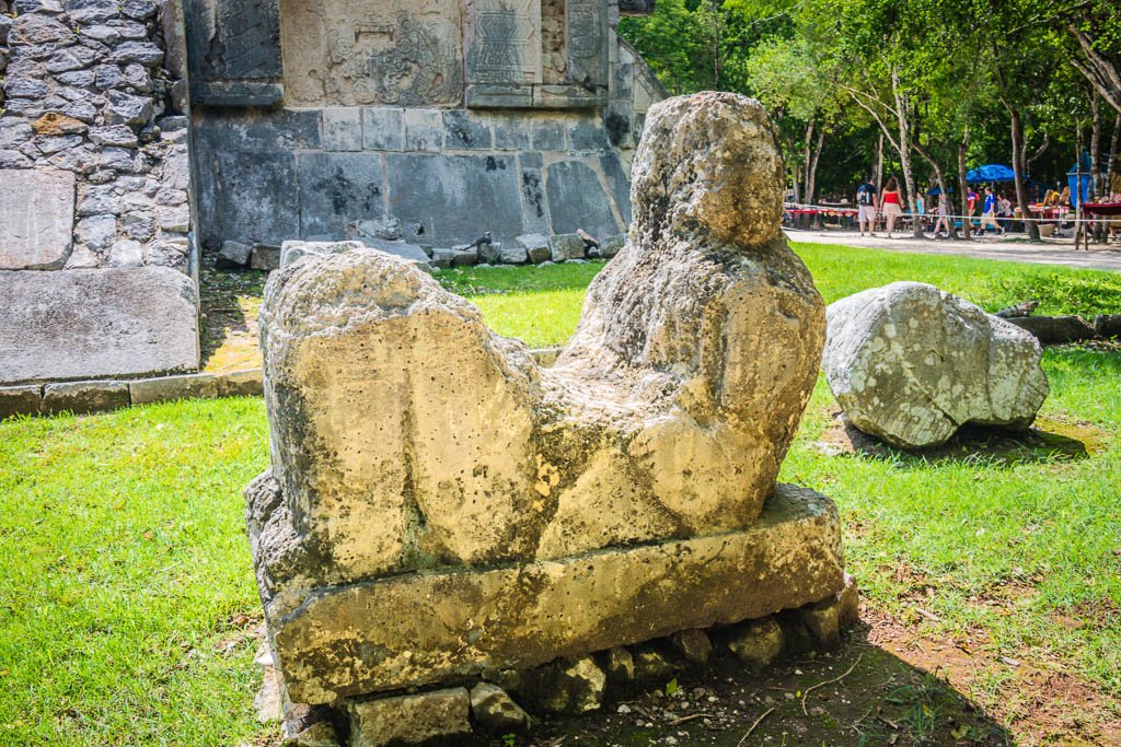
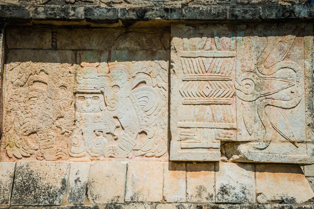
Chac-Mool sculpture, particular to pre-Columbian groups first appearing around the 9th century at Chichén Itzá.
The Maya also invented the mathematical concept of zero and developed a complex system of hieroglyphic writing. Of course, they also constructed lavishly large cities with pyramids, temples, palaces, ball courts, and grand plazas. Which begs the question, why did this seemingly advanced culture for its time disappear? Scholars have put forward numerous theories, one being the Maya were wiped out by a severe drought and the other being deforestation negatively impacted the environment making their advanced farming techniques and way of life unsustainable. To this day, nobody knows for sure what caused their demise.
Chichén Itzá: “Mouth Of The Well Of The Itzá”
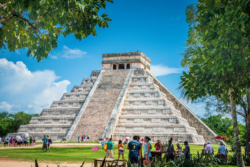
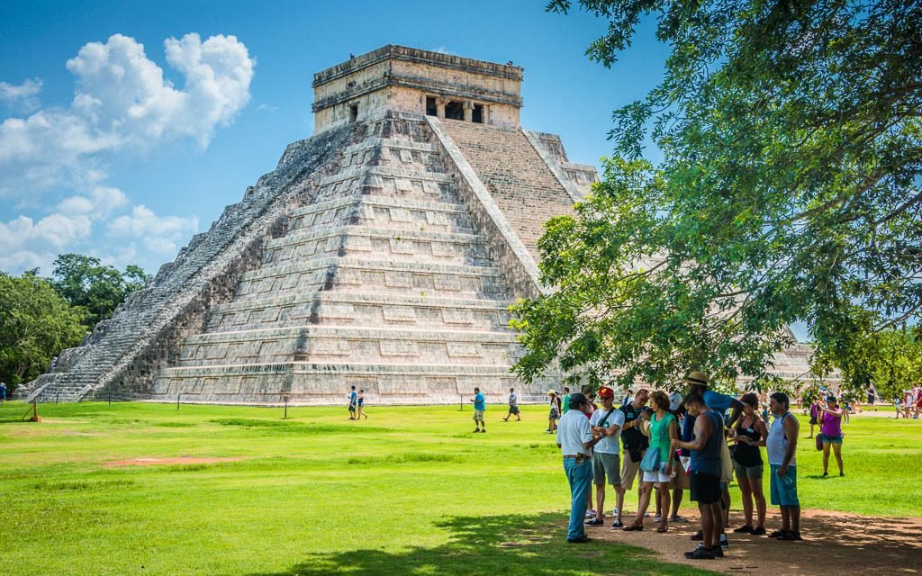
Spanish Conquistadors discovered Chichén Itzá in the early 1500’s, but by then the city had long been abandoned and all the Spanish conquerors found were crumbling buildings overgrown by dense jungle. Strategically located in the heart of the northern Yucatán peninsula roughly half-way between Merida and Cancun, Chichén Itzá is one of Mexico’s most visited tourist destinations with more than two million visitors annually. A ceremonial and sacred center for the ancient Maya civilization, Chichén Itzá, which translates as “Mouth of the Well of the Itzá”, was so named for the large cenote and fresh water source by the first settlers of the city. Tracing its roots to the fifth century AD, Chichén Itzá’s massive archaeological site was declared a UNESCO World Heritage Site in 1988 and its iconic Temple of Kukulkan (locals generally use the pyramid’s Spanish name, El Castillo) was designated one of the New Seven Wonders of the World in 2006.
El Castillo (the Castle) is a 23-metre (75- feet) high multi-tiered pyramid and is the most iconic monument in the city. Back when I made my first visit here in 1987, you could carefully climb to the top of the pyramid. Unfortunately, climbing is no longer allowed due to some tourists who defaced the interior of the six-metre-tall throne room on top of the pyramid. This monument is an astrological wonder with 91 steps per side and the final 365th step on top representing the solar year. Each of the pyramid’s corners faces one of the cardinal directions so that people could use the edifice to navigate. Some people specifically plan to make a visit here during the spring or fall equinoxes (March and September) at about 3PM, when the sun casts triangular shadows down the north side of the pyramid’s terraces to show how the stones have been laid to look like snakes slithering down the staircase. If you prefer to avoid the inevitable huge crowds for this bi-annual event, the shadowy serpent effect is recreated each evening during a spectacular light and sound show which is projected on the pyramid. As if the Maya mysteries are piled on top of one another, in recent years it was discovered that El Castillo was built upon another much older temple.
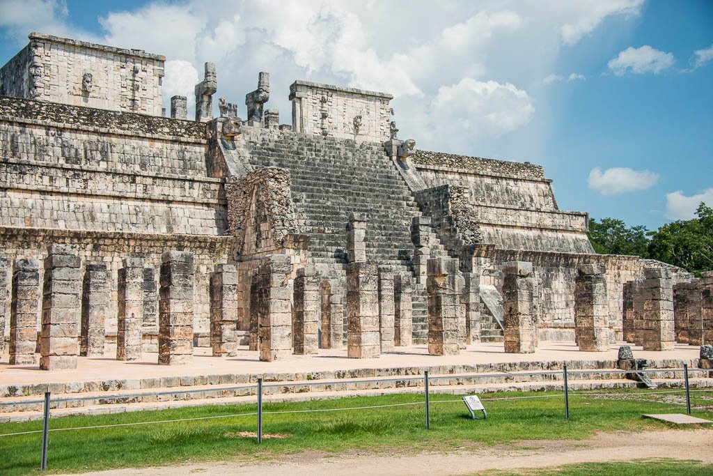
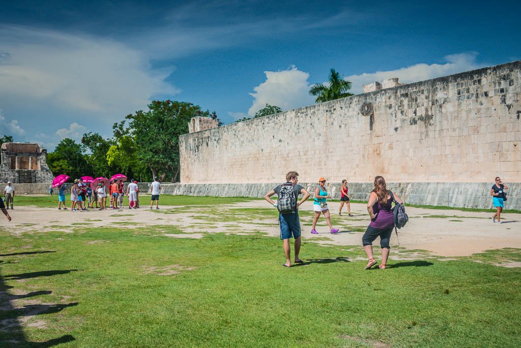
Other notable structures of Chichén Itzá include the astronomical Observatory, the Grand Ball Court the Group of the Thousand Columns, Temple of the Jaguars, the Temple of the Warriors, the Temple of the Wall Panels, and the Sacred Cenoté to name a few. Once a source of water for agriculture, the escape-proof Sacred Cenoté was later used for large scale ceremonial human sacrifices honoring the God of Rain. Many of Chichén Itzá’s stone buildings are also famous for their unusual acoustics. For example, if you stand in just the right spot at the bottom of the El Castillo pyramid and either hand clap, or whistle, you can hear the distinctive echo of a “chirp”. Additionally, if you clap your hands once at one end of the Grand Ball Court, it produces nine echoes in the middle of the court.
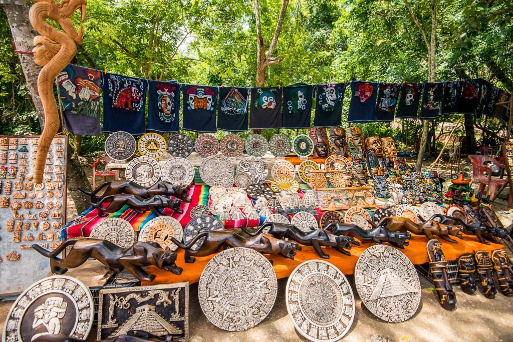
You can purchase so-called Maya handicrafts at Chichén Itzá. But, buyer beware as it is all mostly made in China kitsch souvenirs.
Tulum: A Name Given By Explorers
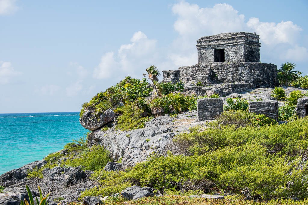
Perched majestically atop a jagged seaside cliff, overlooking a white sand beach and facing east toward the Caribbean Sea, Tulum boasts one of the most attractive settings of all Mexico’s archeological sites. As one of the very few walled cities build by the Maya, it is truly quite stunning in comparison to other Mayan ruins on the Yucatán Peninsula which seems to support that oft heard real estate agents’ mantra, “location, location, location”. Tulum lies just 129- kilometres (80-miles) south of Cancun and receives thousands of visitors every day making it one of the most frequently visited Maya ruins on the entire Riviera Maya. Built as a sea port for Cobá, this ancient walled city formerly may have been called, Zamá, which means “Place of the Dawning Sun.” It’s believed Tulum’s first inhabitants named their city Zama because it faces the sunrise. Tulum, a Mayan word which translates as “trench” or “wall”, is the name given to this city by explorers Stephens and Catherwood in 1841. Interestingly, Tulum’s fortress walls are located on only three sides as the ocean and the sea cliff protects its eastern border.
Built atop a 12-metre (40-feet) limestone cliff rising abruptly from a turquoise sea, the “El Castillo” pyramid is the tallest building within the city and served as a lighthouse that guided ships toward this major port by aligning two torches to help the vessels safely navigate through the surrounding reef. Visible at sea from miles away, this great walled city must have been a sight to behold with its red, white and blue painted buildings and flickering flames emanating from atop the lighthouse. During its heyday, Tulum was a major trading hub for both inland and seafaring goods from as far away as Guatemala and modern-day Honduras and was in effect a trade distribution center for goods going between other settlements along the Yucatán Peninsula, including Cobá and Chichén Itzá.
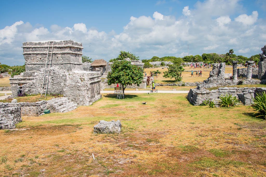
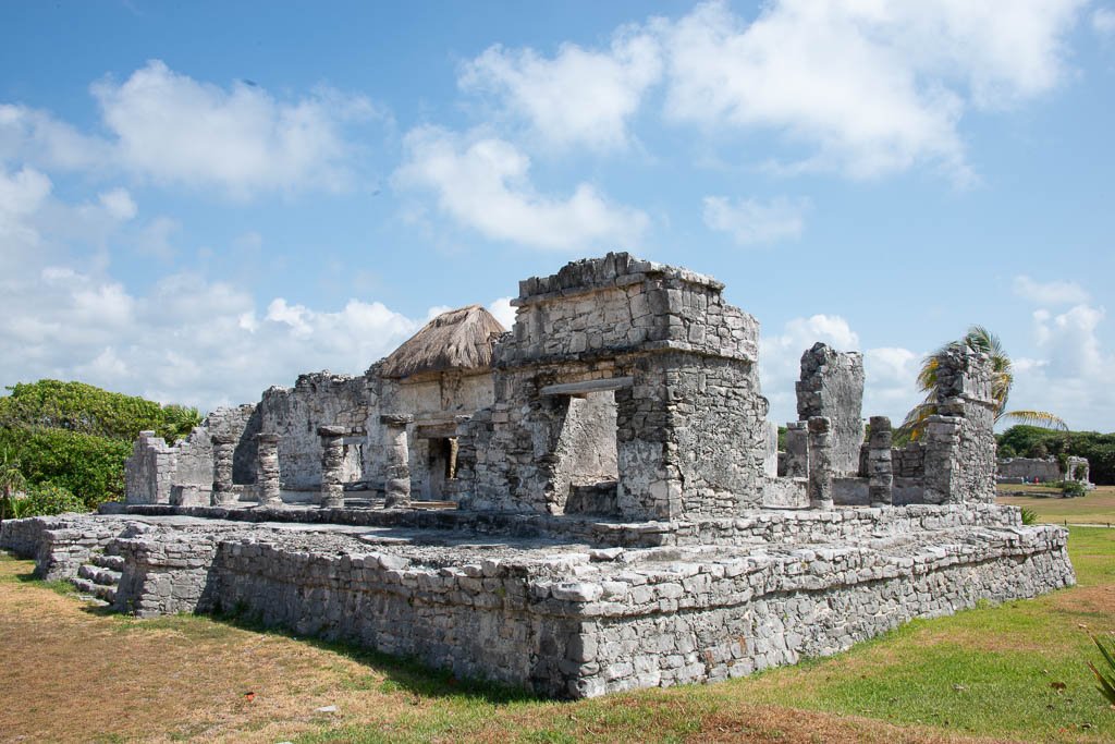
Known to be the last city built and inhabited by the Maya, it is thought to have morphed into a religious center for priests that remained active during the Spanish invasion. By the end of the 16th century, Old World diseases and epidemics brought by the Spanish had decimated the Maya population and Tulum was abandoned. After entering the ruins through one of five doorways in the ruin’s 5-metre (16-feet) high fortress walls, visitors enter a sun-baked compound with gently rolling hills and more than 60 principal and secondary Mayan buildings or structures. Although we have walked these grounds many times, we always learn something new about Tulum’s noble past with each visit.
Cobá: “Waters Stirred By The Wind”
Many moons ago a good friend told me Cobá was his favorite Mayan archeological site. I wholeheartedly agree as these Cobá’s ruins are definitely a “must see” and provides a fertile landscape for channeling your inner Indiana Jones. Less crowded and with fewer visitors than at Chichén Itza or Tulum, Cobá comes closest to being a lost city in the jungle. Cobá, is a Yucatec Maya name which translates as “waters stirred by the wind”, which seems appropriate given the location of its expansive ancient ruins surrounded by two large crocodile-infested lagoons. Centrally and conveniently located just 48-kilometres (30-miles) northwest of Tulum and 60-kilometres (37-miles) southeast of Valladolid, archeologists estimate Cobá was abandoned when the Spanish conquered the Peninsula around 1550. Cobá’s history remained unknown for centuries as the site was not visited by modern day explorers until the 1920’s because the site was inaccessible due to its impenetrable dense jungle and the Caste War of Yucatán (1847–1901).
Archaeologists believe Cobá was one of the most important Mayan settlements as their design and purpose was very different from other Maya cities. Cobá is not a single site, but a large group of man-made ruins spread over more than 80-square kilometres (30-square miles). Over 16 “white limestone roads” called sacbes that originate at the main pyramid and stretch out through the jungle in the four cardinal directions; north, south, east and west. These highways, ranging in width from 3.5 to nine metres (10 to 30-feet), were constructed for commerce. Goods were transported along the sacbes at night when temperatures were cooler than during daylight. Under the moonlight, the white limestone would be illuminated and light the causeway for travellers. Evidently, the ingenuity required to construct these wide and long roadways exceeded that needed to construct Maya stone buildings and temples.
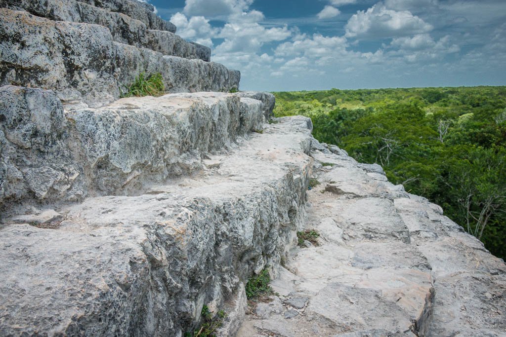
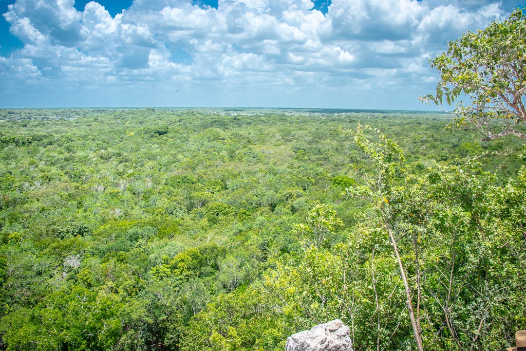
Cobá’s rugged ruins are fascinating to explore. Many structures remain unexcavated and are hidden by lush vegetation and trees growing on and around them. It’s estimated more than 6,000 structures are scattered throughout the jungle, but only three partially-restored settlements are open for public viewing. Cobá’s star attraction is climbing the 120 steps of the Nohoch Mul (which means “great mound”) pyramid. Standing at 42-metres tall (137-feet), this is the tallest pyramid on Riviera Maya and the view from the top of this pyramid provides a stunning panorama of the Yucatan jungle, including both the Macanxoc Lagoon to the east and Cobá Lagoon to the southwest. Every year there seems to be official talk about shutting down climbing to the top of the pyramid, but a climbing ban has yet to be passed. So, the time to visit Cobá is now, Nohoch Mul is closed to pyramid climbers.
How Not to Ruin Your Mayan Riviera Vacation?
Whether you rent a car, join a tour group or take public transportation, Chichén Itzá, Tulum and Cobá require partial to full day trips from Riviera Maya resorts and hotels. If you prefer to enjoy the ruins without being surrounded by crowds of tourists, plan to arrive first thing in the morning or later in the afternoon to avoid crowds bused in from Riviera Maya resorts and hotels. The most optimal time of year to visit Riviera Maya’s archeological ruins is during the dry season which begins in late November and ends in February. Generally, there is less rainfall and daytime temperatures are more tolerable and are certainly not as hot as during the summer months. Extreme heat and humidity during the summer months make the interior sites in the jungle oppressive and mosquitoes are also more prevalent that time of year. Of course, wear some durable walking shoes, put on a sun hat, wipe on some sunscreen and carry some drinking water. If there is an opportunity to do so, don’t pass up a chance to cool yourself down by going for a swim in a Cenoté. Formed by the collapse of porous limestone bedrock, Cenotés are natural groundwater pools that are found throughout the Yucatán Peninsula. The Maya thought these turquoise pools were “Portals to the Underworld”. But hey, that’s fodder for a future column.
Until our next dispatch, dare to Explore…Dream…Discover.
P.S. Bienvenido, Kathryn Britnell!
You may have noticed a new addition to the byline on Third Age Expeditions this month. I’m happy to welcome my wife, Kathryn, as a co-author for this column. A little background information about her. Apart from being married to one of the coolest guys in the known universe (Did, I just type that out loud?) Kathryn, among other things, is an internationally published photojournalist, underwater model, lecturer, conservationist, explorer and a member of the British Columbia Association of Travel Writers. The first published photo of her working as an underwater model appeared in print on December 22, 2010 in PhotographyBB Magazine. Certainly, a notable achievement as she was only certified as a scuba diver three weeks earlier on November 30th in the Philippines! In July 2018, Kathryn was named a Fellow of London’s prestigious Royal Geographical Society (RGS) with the Institute of British Geographers. Fellowship is reserved for those who can demonstrate their academic publications in the field of geography and closely related subjects such as climate change.


![Wickedly Good Halloween Cocktails [COCKTAIL TIME]](https://luxebeatmag.com/wp-content/uploads/2024/10/Diplomatico-Rum-Blood-Moon-Negroni-150x150.jpg)

